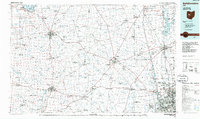
1986 Map of Bellefontaine
USGS Topo · Published 1986About this map
The Scioto River and Olentangy River valleys define the eastern reach of this West Central Ohio landscape, where the growing suburbs of Columbus and Upper Arlington meet established agricultural centers. The map documents a diverse mix of institutional and natural sites, from the State Reformatory For Women near Marysville to the unique ecology of the Cedar Bog State Nature Preserve south of Urbana. In the northwest, Indian Lake serves as a major recreational hub anchored by Russells Point and Lakeview.
Find a feature on this map
208 named features on this map. Tap any name to fly to it.
Don’t see what you’re looking for? This feature index may not catch every label — zoom into the map to look around manually.
Map Details
Editions of this 1986 Bellefontaine Map
This is the sole edition of this map. No revisions or reprints were ever made.
Other maps of this area

1901 · Dublin
USGS Topo · 1:62,500

1902 · Westerville
USGS Topo · 1:62,500

1903 · Dublin
USGS Topo · 1:62,500

1903 · Marion
USGS Topo · 1:62,500

1904 · Westerville
USGS Topo · 1:62,500

1904 · Springfield
USGS Topo · 1:62,500

1904 · Dayton
USGS Topo · 1:62,500

1905 · Marion
USGS Topo · 1:62,500

1906 · Dayton
USGS Topo · 1:62,500

1906 · Springfield
USGS Topo · 1:62,500