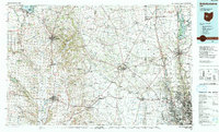
1992 Map of Bellefontaine
USGS Topo · Published 1992About this map
Campbell Hill, the highest point in Ohio, anchors the western portion of this topographic study, overlooking a landscape defined by the Greenville Treaty Line and the rolling terrain of the Marmon Valley. Centered on the hub of Bellefontaine, the map illustrates a network of small agricultural and industrial centers including Urbana, Marysville, and Delaware. The expansion of the Columbus metropolitan area is visible in the southeast, where Dublin and Upper Arlington meet the Scioto River near the O'Shaughnessy Reservoir.
Find a feature on this map
229 named features on this map. Tap any name to fly to it.
Don’t see what you’re looking for? This feature index may not catch every label — zoom into the map to look around manually.
Map Details
Editions of this 1992 Bellefontaine Map
This is the sole edition of this map. No revisions or reprints were ever made.
Other maps of this area

1901 · Dublin
USGS Topo · 1:62,500

1902 · Westerville
USGS Topo · 1:62,500

1903 · Dublin
USGS Topo · 1:62,500

1903 · Marion
USGS Topo · 1:62,500

1904 · Westerville
USGS Topo · 1:62,500

1904 · Springfield
USGS Topo · 1:62,500

1904 · Dayton
USGS Topo · 1:62,500

1905 · Marion
USGS Topo · 1:62,500

1906 · Dayton
USGS Topo · 1:62,500

1906 · Springfield
USGS Topo · 1:62,500