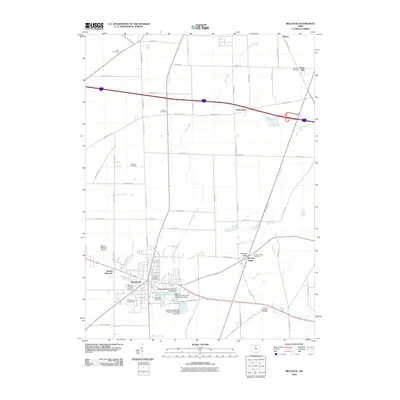
2010 Map of Bellevue
USGS Topo · Published 2010About this map
Bellevue is the primary hub of this landscape, positioned where several key roads converge near a complex system of reservoirs and water infrastructure. The town’s layout is supported by the Bellevue Reservoir Number One and Bellevue Reservoir Number Four, along with their associated dams, reflecting the managed water resources essential for this northern Ohio community. Beyond the municipal center, the map reveals a pattern of rural settlement characterized by small hamlets and significant genealogical markers. Numerous family and community burial grounds, such as Tew Cemetery, Deyo Cemetery, and Wickwire Cemetery, are scattered across the terrain, often located at crossroads or adjacent to established agricultural tracts. Natural and artificial drainage features like Mills Creek, Pipe Creek, and the long Snyders Ditch cut through the fields, illustrating the effort to drain and utilize the land for farming and development. Outlying settlements like Strongs Ridge and Parkertown maintain their distinct positions within the grid of county roads.
Find a feature on this map
61 named features on this map. Tap any name to fly to it.
Don’t see what you’re looking for? This feature index may not catch every label — zoom into the map to look around manually.
Map Details
Editions of this 2010 Bellevue Map
This is the sole edition of this map. No revisions or reprints were ever made.
Other maps of this area

1901 · Bellevue
USGS Topo · 1:62,500

1903 · Bellevue
USGS Topo · 1:62,500

1904 · Sandusky
USGS Topo · 1:62,500

1915 · Norwalk
USGS Topo · 1:62,500

1915 · Siam
USGS Topo · 1:62,500

1944 · Norwalk
USGS Topo · 1:62,500

1956 · Toledo
USGS Topo · 1:250,000

1957 · Vickery
USGS Topo · 1:24,000

1959 · Kimball
USGS Topo · 1:24,000

1959 · Sandusky
USGS Topo · 1:24,000