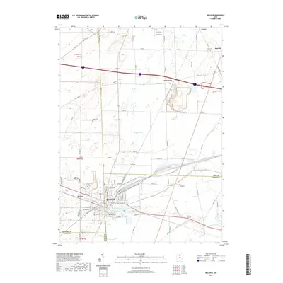
2019 Map of Bellevue
USGS Topo · Published 2019About this map
Bellevue serves as a significant crossroads at the intersection of Sandusky, Erie, Huron, and Seneca counties. This 2019 survey illustrates a complex municipal infrastructure where urban development meets agricultural drainage systems like Snyders Ditch and Hayward Ditch. The landscape is heavily marked by local heritage, featuring numerous burial grounds such as Wickwire Cem, Deyo Cem, and the Strongs Ridge Cem. Residential growth is visible in the neighborhoods around Mount Pleasant and the thoroughfares of W Main St and E Main St. Water management is a defining characteristic of the area, centered on the Bellevue Reservoir Number One and the larger Bellevue Upground Reservoir Number Three. North of the city center, the small communities of Parkertown and Strongs Ridge remain distinct landmarks amidst a network of county roads and the winding paths of Mills Cr and Pipe Cr.
Find a feature on this map
67 named features on this map. Tap any name to fly to it.
Don’t see what you’re looking for? This feature index may not catch every label — zoom into the map to look around manually.
Map Details
Editions of this 2019 Bellevue Map
This is the sole edition of this map. No revisions or reprints were ever made.
Other maps of this area

1901 · Bellevue
USGS Topo · 1:62,500

1903 · Bellevue
USGS Topo · 1:62,500

1904 · Sandusky
USGS Topo · 1:62,500

1915 · Norwalk
USGS Topo · 1:62,500

1915 · Siam
USGS Topo · 1:62,500

1944 · Norwalk
USGS Topo · 1:62,500

1956 · Toledo
USGS Topo · 1:250,000

1957 · Vickery
USGS Topo · 1:24,000

1959 · Kimball
USGS Topo · 1:24,000

1959 · Sandusky
USGS Topo · 1:24,000