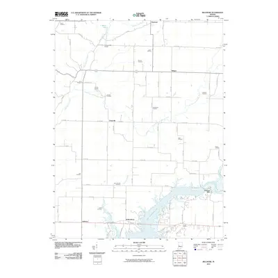
2010 Map of Bellmore
USGS Topo · Published 2010About this map
Cecil M Harden Lake dominates the southern landscape of this 2010 survey, where the waters of Big Raccoon Creek meet several rural settlements. The map illustrates a complex network of small cemeteries and family-named landmarks that anchor the local genealogy of Parke and Montgomery counties. Near the northern edge, Waveland sits along the upper reaches of Little Raccoon Creek, while the historic crossing at Portland Mills Bridge provides a point of interest for those tracing old infrastructure. The settlement of Portland Mills is situated at the eastern edge of the reservoir, reflecting the local community's relationship with the water. Numerous burial grounds, including the Philadelphia Cemetery, Mount Moriah Cemetery, and Pisgah Cemetery, are scattered across the rural grid, offering vital clues for researchers tracing the early inhabitants of Hollandsburg and Parkeville.
Find a feature on this map
69 named features on this map. Tap any name to fly to it.
Don’t see what you’re looking for? This feature index may not catch every label — zoom into the map to look around manually.
Map Details
Editions of this 2010 Bellmore Map
This is the sole edition of this map. No revisions or reprints were ever made.
Other maps of this area

1948 · Wallace
USGS Topo · 1:24,000

1949 · Alamo
USGS Topo · 1:24,000

1951 · Clinton Falls
USGS Topo · 1:24,000

1951 · Mansfield
USGS Topo · 1:24,000

1952 · Catlin
USGS Topo · 1:24,000

1953 · Indianapolis
USGS Topo · 1:250,000

1955 · Rockville
USGS Topo · 1:24,000

1955 · Russellville
USGS Topo · 1:24,000

1956 · Indianapolis
USGS Topo · 1:250,000

1956 · New Market
USGS Topo · 1:24,000