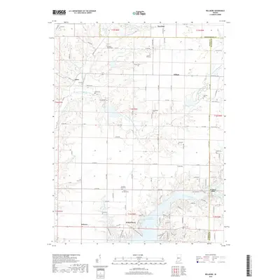
2019 Map of Bellmore
USGS Topo · Published 2019About this map
Cecil M Harden Lake dominates the southern landscape of this West-Central Indiana quadrangle, where the borders of Montgomery, Parke, and Putnam counties converge. The terrain is defined by the winding paths of Big Raccoon Creek and Little Raccoon Creek, which feed into the reservoir system. This map captures a region deeply rooted in agricultural and small-town life, featuring scattered settlements such as Portland Mills, Hollandsburg, and Bellmore.
Find a feature on this map
78 named features on this map. Tap any name to fly to it.
Don’t see what you’re looking for? This feature index may not catch every label — zoom into the map to look around manually.
Map Details
Editions of this 2019 Bellmore Map
This is the sole edition of this map. No revisions or reprints were ever made.
Other maps of this area

1948 · Wallace
USGS Topo · 1:24,000

1949 · Alamo
USGS Topo · 1:24,000

1951 · Clinton Falls
USGS Topo · 1:24,000

1951 · Mansfield
USGS Topo · 1:24,000

1952 · Catlin
USGS Topo · 1:24,000

1953 · Indianapolis
USGS Topo · 1:250,000

1955 · Rockville
USGS Topo · 1:24,000

1955 · Russellville
USGS Topo · 1:24,000

1956 · Indianapolis
USGS Topo · 1:250,000

1956 · New Market
USGS Topo · 1:24,000