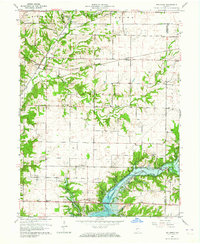
1963 Map of Bellmore
USGS Topo · Published 1964About this map
Big Raccoon Creek and its newly formed Mansfield Reservoir dominate this mid-century portrait of eastern Parke County. The landscape is a transition between the established rail corridors of the north and the emerging water-based leisure economy of the south, anchored by the Raccoon Lake State Recreation Area. Small agrarian settlements like Portland Mills and Hollandsburg sit near the water's edge, while the crossing of the Pennsylvania RR and the Baltimore and Ohio RR at Guion and Milligan preserves the importance of steam-era transportation.
Find a feature on this map
44 named features on this map. Tap any name to fly to it.
Don’t see what you’re looking for? This feature index may not catch every label — zoom into the map to look around manually.
Map Details
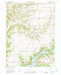
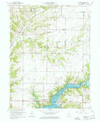
Editions of this 1963 Bellmore Map
3 editions found
Other maps of this area

1948 · Wallace
USGS Topo · 1:24,000

1949 · Alamo
USGS Topo · 1:24,000

1951 · Clinton Falls
USGS Topo · 1:24,000

1951 · Mansfield
USGS Topo · 1:24,000

1952 · Catlin
USGS Topo · 1:24,000

1953 · Indianapolis
USGS Topo · 1:250,000

1955 · Rockville
USGS Topo · 1:24,000

1955 · Russellville
USGS Topo · 1:24,000

1956 · Indianapolis
USGS Topo · 1:250,000

1956 · New Market
USGS Topo · 1:24,000