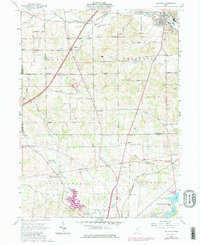
1961 Map of Bellville
USGS Topo · Published 1975About this map
The Clear Fork river winds through the northern portion of this landscape, anchoring the village of Bellville, where the Lutheran Ch and local infrastructure are clustered along the water. The map documents a complex rural geography shaped by the Treaty Line Road, which marks the historical boundary between the Congress Lands of the north and the United States Military District to the south. This jurisdictional division is reflected in the layout of townships like Perry, Jefferson, and Middlebury.
Find a feature on this map
56 named features on this map. Tap any name to fly to it.
Don’t see what you’re looking for? This feature index may not catch every label — zoom into the map to look around manually.
Map Details
Editions of this 1961 Bellville Map
Other maps of this area

1912 · Gambier
USGS Topo · 1:62,500

1912 · Perrysville
USGS Topo · 1:62,500

1914 · Gambier
USGS Topo · 1:62,500

1915 · Perrysville
USGS Topo · 1:62,500

1915 · Shauck
USGS Topo · 1:62,500

1915 · Fredericktown
USGS Topo · 1:62,500

1943 · Shauck
USGS Topo · 1:62,500

1943 · Gambier
USGS Topo · 1:62,500

1943 · Fredericktown
USGS Topo · 1:62,500

1944 · Perrysville
USGS Topo · 1:62,500