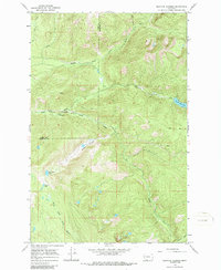
1965 Map of Belmore Sloughs
USGS Topo · Published 1986About this map
The Middle Fork Jocko River and its southern tributaries define this mid-1960s landscape within the Flathead Indian Reservation. Stretching across the boundary of Lake and Missoula counties, the terrain is marked by high alpine basins and the namesake Belmore Sloughs. Mapping from this era captures a wilderness managed for both conservation and seasonal recreation, with the Jocko Lookout positioned as a high-altitude sentry overlooking the drainage. The map provides a detailed view of the early recreational infrastructure in the region, including the Cedar Campground and Twin Campground. Significant water features like White Horse Lake and Meadow Lake sit in the southwestern quadrant, while the Pack Trail network indicates the primary means of navigating these steep grades before modern road development was fully established.
Find a feature on this map
15 named features on this map. Tap any name to fly to it.
Don’t see what you’re looking for? This feature index may not catch every label — zoom into the map to look around manually.
Map Details
Editions of this 1965 Belmore Sloughs Map
2 editions found
Other maps of this area

1921 · Elbow Lake
USGS Topo · 1:125,000

1955 · Choteau
USGS Topo · 1:250,000

1957 · Choteau
USGS Topo · 1:250,000

1958 · Choteau
USGS Topo · 1:250,000

1962 · Choteau
USGS Topo · 1:250,000

1965 · Upper Jocko Lake
USGS Topo · 1:24,000
1965 · Belmore Sloughs
USGS Topo · 1:24,000
1965 · Gold Creek Peak
USGS Topo · 1:24,000
1965 · Stuart Peak
USGS Topo · 1:24,000

1965 · Gray Wolf Lake
USGS Topo · 1:24,000