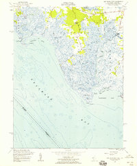
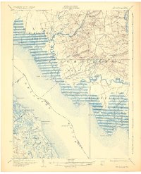
1956 Map of Ben Davis Point
USGS Topo · Published 1958About this map
Cohansey River meets the salt marshes of Cumberland County in this 1956 survey, revealing a landscape defined by tidal creeks and coastal points. Small outposts of human activity like Loyds Corner and Husted Landing are connected by narrow routes such as Back Neck Road, while the shoreline is punctuated by Cohansey Pt and Ben Davis Pt. This era shows the coastal environment before significant modern alteration, where maritime navigation relied on the Cohansey Outer Lt (C) and Cohansey Inner Lt (C). The intricate drainage pattern of Lawrence Creek and Abbot Creek demonstrates the complex topography of the Fairfield and Lawrence townships as they give way to Delaware Bay.
Find a feature on this map
52 named features on this map. Tap any name to fly to it.
Don’t see what you’re looking for? This feature index may not catch every label — zoom into the map to look around manually.
Map Details
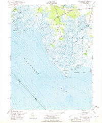
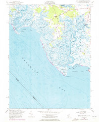
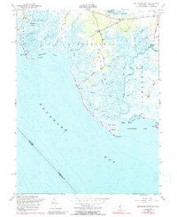
Editions of this 1956 Ben Davis Point Map
4 editions found
Other maps of this area

1890 · Maurice Cove
USGS Topo · 1:62,500

1890 · Bay Side
USGS Topo · 1:62,500

1890 · Bridgeton
USGS Topo · 1:62,500

1891 · Maurice Cove
USGS Topo · 1:62,500

1894 · Bay Side
USGS Topo · 1:62,500

1894 · Bridgeton
USGS Topo · 1:62,500

1899 · Vineland
USGS Topo · 1:125,000

1919 · Vineland
USGS Topo · 1:125,000
1931 · Bay Side
USGS Topo · 1:62,500
1934 · Bowers
USGS Topo · 1:48,000
Featured Places
- Fairfield Township, NJ
- Hopewell Township, NJ
- Lawrence Township, NJ
- Greenwich Township, NJ
- Loyds Corner, Fairfield Township