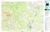
1980 Map of Bend
USGS Topo · Published 1993About this map
Bend and the neighboring high desert settlements of Redmond and Sisters anchor this late-twentieth-century study of Central Oregon. The landscape is defined by the sharp transition from the volcanic peaks of the Three Sisters Wilderness and Mt Jefferson Wilderness to the arid plains of the Crooked River National Grassland. The Deschutes River and Crooked River carve deep canyons through the basalt, providing the lifeblood for communities like Terrebonne and Tumalo. Transport corridors such as the Burlington Northern and Oregon Trunk railroads, along with Roberts Field at Redmond, illustrate the region's role as a mountain-crossroads hub. Notable landmarks including the towering Black Butte and the sheer walls of Smith Rock State Park stand out against the vast timber holdings of the Deschutes National Forest and Willamette National Forest.
Find a feature on this map
125 named features on this map. Tap any name to fly to it.
Don’t see what you’re looking for? This feature index may not catch every label — zoom into the map to look around manually.
Map Details
Editions of this 1980 Bend Map
2 editions found
Other maps of this area

1925 · Waldo Lake
USGS Topo · 1:125,000

1926 · Bend
USGS Topo · 1:125,000

1927 · Mt. Jefferson
USGS Topo · 1:125,000

1928 · Madras
USGS Topo · 1:125,000

1929 · Mill City
USGS Topo · 1:125,000

1929 · Bend
USGS Topo · 1:125,000

1929 · Three Sisters
USGS Topo · 1:125,000

1930 · Maiden Peak
USGS Topo · 1:125,000

1930 · Mt. Jefferson
USGS Topo · 1:125,000

1931 · Madras
USGS Topo · 1:125,000