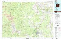
1980 Map of Bend
USGS Topo · Published 1993About this map
Bend and the high desert interior of Central Oregon are captured here during a period of significant regional growth and infrastructure consolidation. The map illustrates the convergence of major travel routes, with US Highway 97 and US Highway 20 meeting in a hub that connects the agricultural lands around Redmond and Terrebonne to the mountain corridors. The landscape is defined by its volcanic heritage, dominated by the peaks of the Three Sisters—specifically North Sister, Middle Sister, and South Sister—alongside notable landmarks like Broken Top and the prominent Black Butte.
Find a feature on this map
59 named features on this map. Tap any name to fly to it.
Don’t see what you’re looking for? This feature index may not catch every label — zoom into the map to look around manually.
Map Details
Editions of this 1980 Bend Map
2 editions found
Other maps of this area

1925 · Waldo Lake
USGS Topo · 1:125,000

1926 · Bend
USGS Topo · 1:125,000

1927 · Mt. Jefferson
USGS Topo · 1:125,000

1928 · Madras
USGS Topo · 1:125,000

1929 · Mill City
USGS Topo · 1:125,000

1929 · Bend
USGS Topo · 1:125,000

1929 · Three Sisters
USGS Topo · 1:125,000

1930 · Maiden Peak
USGS Topo · 1:125,000

1930 · Mt. Jefferson
USGS Topo · 1:125,000

1931 · Madras
USGS Topo · 1:125,000