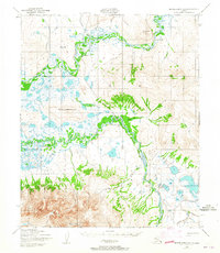
1950 Map of Bendeleben A-6
USGS Topo · Published 1965About this map
Pilgrim Springs and the northern foothills of the Kigluaiak Mountains dominate this mid-century survey of the Seward Peninsula. The landscape is defined by the winding paths of the Kuzitrin River and Pilgrim River, where the presence of an Old Railroad Grade and various tractor roads indicates a history of resource extraction and seasonal movement. The mapping reveals a sparse infrastructure suited to the subarctic environment, featuring a Highway Maintenance Station and a Landing Strip (Aband) near the thermal area of the springs.
Find a feature on this map
25 named features on this map. Tap any name to fly to it.
Don’t see what you’re looking for? This feature index may not catch every label — zoom into the map to look around manually.
Map Details
Editions of this 1950 Bendeleben A-6 Map
3 editions found
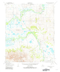
Other maps of this area

1907 · Casadepaga
USGS Topo · 1:62,500

1950 · Bendeleben A-6
USGS Topo · 1:63,360

1950 · Bendeleben B-5
USGS Topo · 1:63,360

1950 · Bendeleben B-6
USGS Topo · 1:63,360

1950 · Bendeleben A-5
USGS Topo · 1:63,360

1950 · Nome
USGS Topo · 1:250,000

1950 · Teller
USGS Topo · 1:250,000

1950 · Bendeleben
USGS Topo · 1:250,000

1950 · Solomon
USGS Topo · 1:250,000

1950 · Solomon D-6
USGS Topo · 1:63,360