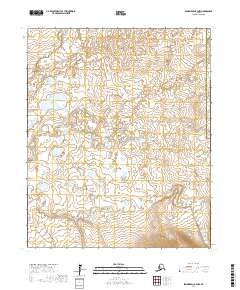
2017 Map of Bendeleben B-4 NW
USGS Topo · Published 2017About this map
The Seward Peninsula landscape is defined by the expansive Bering Land Bridge National Preserve, a protected area within the Nome Census Area that preserves a critical prehistoric corridor. This 2017 survey illustrates the complex drainage network of the interior, where the Kuzitrin River meets its major tributaries. The confluence of the N Fork Kuzitrin River and S Fork Kuzitrin River marks a primary hydrological junction in a region devoid of permanent settlements or roads. In the southern portion of the map, Minnie Cr winds through the tundra, reflecting the low-lying, water-dominant character of this subarctic environment. The presence of the Northwest Arctic Borough boundary in the northeast corner highlights the administrative divisions of this remote Alaskan interior, largely unchanged by modern infrastructure.
Find a feature on this map
11 named features on this map. Tap any name to fly to it.
Don’t see what you’re looking for? This feature index may not catch every label — zoom into the map to look around manually.
Map Details
Editions of this 2017 Bendeleben B-4 NW Map
This is the sole edition of this map. No revisions or reprints were ever made.
Other maps of this area

1950 · Bendeleben C-5
USGS Topo · 1:63,360

1950 · Bendeleben B-5
USGS Topo · 1:63,360

1950 · Bendeleben B-4
USGS Topo · 1:63,360

1950 · Bendeleben C-4
USGS Topo · 1:63,360

1950 · Bendeleben
USGS Topo · 1:250,000

1951 · Bendeleben
USGS Topo · 1:250,000

1964 · Bendeleben
USGS Topo · 1:250,000
2017 · Bendeleben B-5 NE
USGS Topo · 1:25,000
2017 · Bendeleben B-5 SE
USGS Topo · 1:25,000
2017 · Bendeleben C-5 SE
USGS Topo · 1:25,000