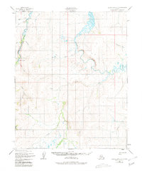
1950 Map of Bendeleben D-2
USGS Topo · Published 1981About this map
The Inmachuk River and Kigrua River anchor this remote landscape in the Northwest Arctic, captured through photogrammetric methods from aerial photographs taken in 1949 and 1950. The map reveals a region defined by its waterway network, including the Burnt River and numerous tributaries such as Arizona Creek and California Creek. Evidence of aviation and early resource exploration is found at the Utica Creek Landing Strip and a solitary Mine located along the Inmachuk. Small isolated Cabin and Cabins structures are noted near the landing strip, suggesting seasonal use or subsistence bases in this roadless area of the Seward Peninsula. The intricate drainage patterns of Mystic Creek and Goldbug Creek provide a detailed look at the hydrology of the Bendeleben quadrangle before modern development altered the landscape.
Find a feature on this map
18 named features on this map. Tap any name to fly to it.
Don’t see what you’re looking for? This feature index may not catch every label — zoom into the map to look around manually.
Map Details
Editions of this 1950 Bendeleben D-2 Map
3 editions found
Other maps of this area

1950 · Kotzebue A-1
USGS Topo · 1:63,360

1950 · Bendeleben C-1
USGS Topo · 1:63,360

1950 · Bendeleben C-3
USGS Topo · 1:63,360

1950 · Bendeleben C-2
USGS Topo · 1:63,360

1950 · Bendeleben D-2
USGS Topo · 1:63,360

1950 · Bendeleben
USGS Topo · 1:250,000

1950 · Bendeleben D-3
USGS Topo · 1:63,360

1950 · Bendeleben D-1
USGS Topo · 1:63,360

1950 · Kotzebue A-3
USGS Topo · 1:63,360

1950 · Kotzebue A-2
USGS Topo · 1:63,360