
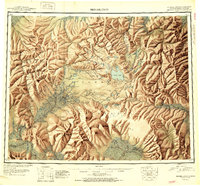
1951 Map of Bendeleben
USGS Topo · Published 1951About this map
Seward Peninsula interior reaches are revealed in this mid-century reconnaissance, dominated by the Bendeleben Mountains and the volcanic features of the northern interior. The landscape is dotted with remote outposts such as Serpentine Hot Springs and Aurora, alongside evidence of the region's industrial past like the Candle Ditch and a Railroad (Abandoned) stretching toward Shelton. The map documents a critical infrastructure of survival, noting a Telephone Shelter Cabin and various airstrips that served as lifelines between isolated settlements like Noxapaga and Bunker Hill Crossing. From the heights of Mt Bendeleben to the geothermal waters at Pilgrim Springs, this survey records the complex terrain where miners and hunters navigated an environment of lava cones and glacial valleys before the modern expansion of the bush pilot era.
Find a feature on this map
199 named features on this map. Tap any name to fly to it.
Don’t see what you’re looking for? This feature index may not catch every label — zoom into the map to look around manually.
Map Details
Editions of this 1951 Bendeleben Map
2 editions found
Other maps of this area

1907 · Casadepaga
USGS Topo · 1:62,500

1948 · Norton Bay
USGS Topo · 1:250,000

1950 · Kotzebue A-1
USGS Topo · 1:63,360

1950 · Bendeleben C-5
USGS Topo · 1:63,360

1950 · Bendeleben A-6
USGS Topo · 1:63,360

1950 · Bendeleben B-5
USGS Topo · 1:63,360

1950 · Bendeleben A-4
USGS Topo · 1:63,360

1950 · Bendeleben C-1
USGS Topo · 1:63,360

1950 · Bendeleben C-3
USGS Topo · 1:63,360

1950 · Bendeleben B-6
USGS Topo · 1:63,360