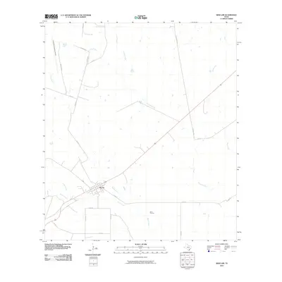
2010 Map of Berclair
USGS Topo · Published 2010About this map
Berclair serves as the central hub of this Goliad County landscape, situated where several local routes and watercourses converge. The settlement is positioned along a corridor defined by Blanco Creek and Millers Creek, which drain the surrounding prairie lands toward the southeast. To the north, the sprawling grounds of the Goliad Naval Auxiliary Airfield dominate the terrain, reflecting the area's twentieth-century military aviation history.
Find a feature on this map
24 named features on this map. Tap any name to fly to it.
Don’t see what you’re looking for? This feature index may not catch every label — zoom into the map to look around manually.
Map Details
Editions of this 2010 Berclair Map
This is the sole edition of this map. No revisions or reprints were ever made.
Other maps of this area

1953 · Beeville
USGS Topo · 1:250,000

1954 · Skidmore
USGS Topo · 1:62,500

1954 · Refugio
USGS Topo · 1:62,500

1956 · Beeville
USGS Topo · 1:250,000

1960 · Beeville
USGS Topo · 1:250,000

1962 · Melo
USGS Topo · 1:24,000

1962 · Goliad
USGS Topo · 1:24,000

1963 · Lazy F Ranch
USGS Topo · 1:24,000
1963 · Berclair NW
USGS Topo · 1:24,000

1963 · Berclair
USGS Topo · 1:24,000