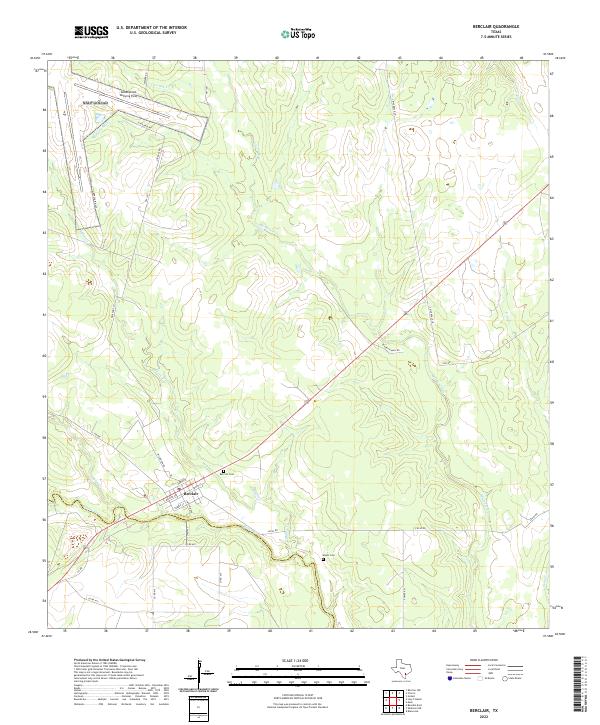
2022 Map of Berclair
USGS Topo · Published 2022About this map
Berclair sits at the southern edge of this modern survey, marking the intersection of regional transit routes near the boundary between Goliad County and Bee County. The landscape is defined by the winding course of Blanco Creek and its many tributaries, including Mucorrera Creek and Millers Creek, which cut through the ranchland of the Texas coastal plain. To the north, the Goliad Naval Outlying Field remains a prominent landmark, situated among a network of local roads such as Welder Rd and FM 1351. This map is particularly valuable for genealogists and local historians, as it precisely locates the Berclair Cemetery and Myers Cemetery, preserving these sites within the contemporary rural landscape of Goliad County.
Find a feature on this map
35 named features on this map. Tap any name to fly to it.
Don’t see what you’re looking for? This feature index may not catch every label — zoom into the map to look around manually.
Map Details
Editions of this 2022 Berclair Map
This is the sole edition of this map. No revisions or reprints were ever made.
Other maps of this area

1953 · Beeville
USGS Topo · 1:250,000

1954 · Skidmore
USGS Topo · 1:62,500

1954 · Refugio
USGS Topo · 1:62,500

1956 · Beeville
USGS Topo · 1:250,000

1960 · Beeville
USGS Topo · 1:250,000

1962 · Melo
USGS Topo · 1:24,000

1962 · Goliad
USGS Topo · 1:24,000

1963 · Lazy F Ranch
USGS Topo · 1:24,000
1963 · Berclair NW
USGS Topo · 1:24,000

1963 · Berclair
USGS Topo · 1:24,000