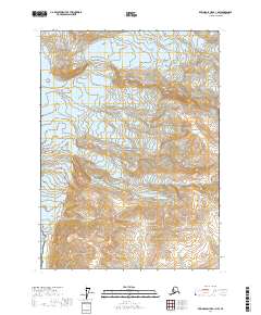
2017 Map of Bering Glacier A-1 NW
USGS Topo · Published 2017About this map
Wrangell-Saint Elias National Park dominates this terrain, where massive ice fields meet the southern coastline. The landscape is defined by the slow movement of glacial systems, including Yahyse Glacier, Coal Glacier, and Daisy Glacier, which carve through the high elevations. These frozen rivers flow toward the southern edge of the map, where the elevation drops toward the Gulf of Alaska. The presence of the Karr Hills provides a rare terrestrial landmark amidst the extensive ice and snow cover. This 2017 survey captures the remote character of the Yakutat region, illustrating the intricate contours of the park's glaciated interior. The map focuses on the natural topography and glacial extent, showing no established roads or settlements in this protected wilderness area.
Find a feature on this map
13 named features on this map. Tap any name to fly to it.
Don’t see what you’re looking for? This feature index may not catch every label — zoom into the map to look around manually.
Map Details
Editions of this 2017 Bering Glacier A-1 NW Map
This is the sole edition of this map. No revisions or reprints were ever made.
Other maps of this area

1950 · Bering Glacier
USGS Topo · 1:250,000

1951 · Bering Glacier
USGS Topo · 1:250,000

1951 · Bering Glacier A-2
USGS Topo · 1:63,360

1959 · Bering Glacier
USGS Topo · 1:250,000

1959 · Bering Glacier A-2
USGS Topo · 1:63,360
1985 · Bering Glacier B-1
USGS Topo · 1:63,360
1985 · Bering Glacier A-1
USGS Topo · 1:63,360
1985 · Bering Glacier B-2
USGS Topo · 1:63,360
2017 · Bering Glacier A-1 SE
USGS Topo · 1:25,000
2017 · Bering Glacier A-1 NE
USGS Topo · 1:25,000