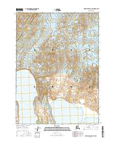
2016 Map of Bering Glacier A-7 NW
USGS Topo · Published 2016About this map
Bering Glacier dominates this 2016 topographic survey, showing the complex ice and debris patterns of one of North America's most significant glacial systems. The map captures the glacial terminus where it meets the Tashalich Arm, illustrating the dynamic interface between moving ice and tidal waters. A prominent Central Medial Moraine Band is clearly delineated, representing the accumulation of rock and soil debris carried by the ice flow. This landscape is a remote segment of the Yakutat City and Borough and the Valdez-Cordova Census Area, highlighting the intricate political boundaries that intersect this largely uninhabited wilderness. The survey serves as a precise record of glacial positioning and shoreline morphology during the early twenty-first century.
Find a feature on this map
8 named features on this map. Tap any name to fly to it.
Don’t see what you’re looking for? This feature index may not catch every label — zoom into the map to look around manually.
Map Details
Editions of this 2016 Bering Glacier A-7 NW Map
This is the sole edition of this map. No revisions or reprints were ever made.
Other maps of this area

1950 · Bering Glacier
USGS Topo · 1:250,000

1951 · Bering Glacier
USGS Topo · 1:250,000

1959 · Bering Glacier
USGS Topo · 1:250,000
1984 · Bering Glacier A-8
USGS Topo · 1:63,360
1984 · Bering Glacier A-7
USGS Topo · 1:63,360
1985 · Bering Glacier B-8
USGS Topo · 1:63,360
1985 · Bering Glacier B-7
USGS Topo · 1:63,360
2014 · Bering Glacier B-8 SE
USGS Topo · 1:25,000
2014 · Bering Glacier A-8 SE
USGS Topo · 1:25,000
2014 · Bering Glacier A-8 NE
USGS Topo · 1:25,000