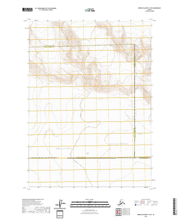
2024 Map of Bering Glacier C-3 SW
USGS Topo · Published 2024About this map
The Wrangell-St. Elias Wilderness dominates this high-latitude terrain, where the massive ice fields of the Saint Elias Mountains feed into complex glacial systems. The Bering Glacier is the primary feature of the southern sections, its vast footprint joined by the Bagley Ice Valley to the west. This map documents a dynamic frozen landscape at a time of significant cryospheric change, illustrating the interface between these immense ice flows and the administrative boundaries of the Chugach Census Area, Copper River Census Area, and Yakutat Borough. To the east, the Tana Glacier marks the edge of this glacial complex, highlighting the scale of the ice-dominated geography that defines this portion of Alaska.
Find a feature on this map
15 named features on this map. Tap any name to fly to it.
Don’t see what you’re looking for? This feature index may not catch every label — zoom into the map to look around manually.
Map Details
Editions of this 2024 Bering Glacier C-3 SW Map
This is the sole edition of this map. No revisions or reprints were ever made.
Other maps of this area

1950 · Bering Glacier
USGS Topo · 1:250,000

1951 · Bering Glacier
USGS Topo · 1:250,000

1959 · Bering Glacier
USGS Topo · 1:250,000
1985 · Bering Glacier B-4
USGS Topo · 1:63,360
1985 · Bering Glacier B-3
USGS Topo · 1:63,360
1985 · Bering Glacier C-4
USGS Topo · 1:63,360
1985 · Bering Glacier C-3
USGS Topo · 1:63,360
2016 · Bering Glacier C-4 SE
USGS Topo · 1:25,000
2016 · Bering Glacier C-4 NE
USGS Topo · 1:25,000
2016 · Bering Glacier B-4 NE
USGS Topo · 1:25,000