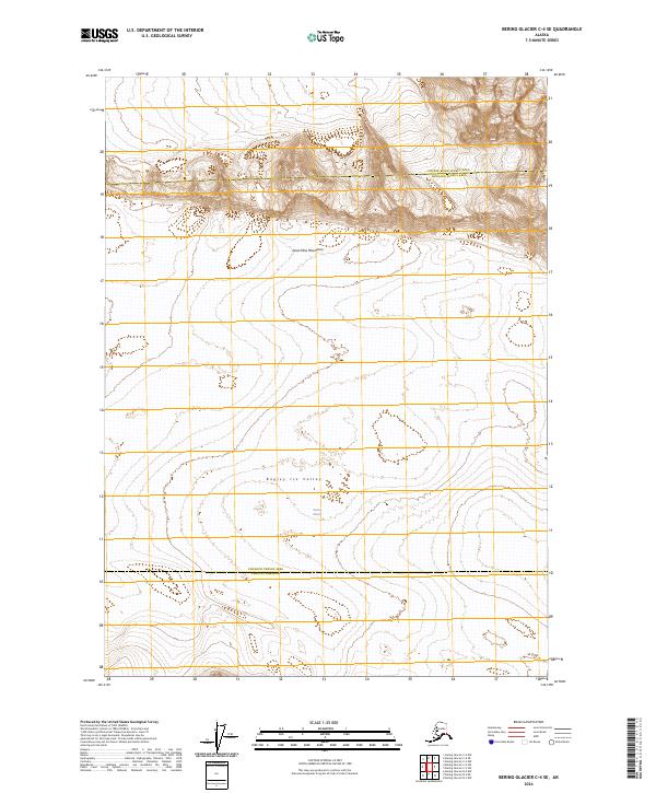
2024 Map of Bering Glacier C-4 SE
USGS Topo · Published 2024About this map
The vast expanse of the Bagley Ice Valley dominates this 2024 landscape, representing one of the most significant glacial features in the region. Flowing through the Saint Elias Mountains, this massive corridor of ice feeds directly into the upper reaches of the Bering Glacier, which covers much of the lower half of the quadrangle. The map captures a wilderness area defined by high-altitude glacial movement and dramatic topography, with the northern boundary of the Wrangell-St. Elias Wilderness bisecting the ice field. This area sits at the intersection of several administrative districts, including the Chugach Census Area Yakutat Borough and the Copper River Census Area Chugach Census Area. The absence of roads or permanent structures underscores the isolation of this corner of the Alaska coast, where the landscape is shaped entirely by ice and tectonic scale.
Find a feature on this map
12 named features on this map. Tap any name to fly to it.
Don’t see what you’re looking for? This feature index may not catch every label — zoom into the map to look around manually.
Map Details
Editions of this 2024 Bering Glacier C-4 SE Map
This is the sole edition of this map. No revisions or reprints were ever made.
Other maps of this area

1950 · Bering Glacier
USGS Topo · 1:250,000

1951 · Bering Glacier
USGS Topo · 1:250,000

1959 · Bering Glacier
USGS Topo · 1:250,000
1985 · Bering Glacier B-4
USGS Topo · 1:63,360
1985 · Bering Glacier B-3
USGS Topo · 1:63,360
1985 · Bering Glacier C-4
USGS Topo · 1:63,360
1985 · Bering Glacier C-3
USGS Topo · 1:63,360
2016 · Bering Glacier C-4 SE
USGS Topo · 1:25,000
2016 · Bering Glacier B-4 NW
USGS Topo · 1:25,000
2016 · Bering Glacier C-4 NE
USGS Topo · 1:25,000