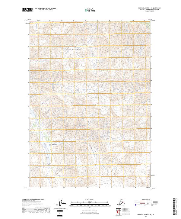
2024 Map of Bering Glacier D-3 NE
USGS Topo · Published 2024About this map
The Wrangell-St. Elias Wilderness encompasses the vast majority of this high-elevation terrain, where the topographic relief is defined by the massive summits of the Saint Elias Mountains and the Granite Range. This is a landscape shaped by hydrology and elevation, where seasonal drainage systems like Goat Creek and Iron Creek carve through the steep glacial valleys. The absence of roads or permanent settlements reflects the strictly protected status of the wilderness area. Researchers and cartography enthusiasts can study the intricate drainage patterns of Quartz Creek and Granite Creek, which illuminate the natural erosion cycles in one of the most remote corners of the Copper River Census Area. The map provides a precise record of the current glacial and geological boundaries at the start of the 2020s.
Find a feature on this map
11 named features on this map. Tap any name to fly to it.
Don’t see what you’re looking for? This feature index may not catch every label — zoom into the map to look around manually.
Map Details
Editions of this 2024 Bering Glacier D-3 NE Map
This is the sole edition of this map. No revisions or reprints were ever made.
Other maps of this area

1950 · Bering Glacier
USGS Topo · 1:250,000

1951 · McCarthy
USGS Topo · 1:250,000

1951 · Bering Glacier
USGS Topo · 1:250,000

1959 · McCarthy A-2
USGS Topo · 1:63,360

1959 · McCarthy A-3
USGS Topo · 1:63,360

1959 · Bering Glacier
USGS Topo · 1:250,000

1960 · McCarthy
USGS Topo · 1:250,000
1984 · Bering Glacier D-2
USGS Topo · 1:63,360
1984 · Bering Glacier D-3
USGS Topo · 1:63,360
2017 · Bering Glacier D-2 SW
USGS Topo · 1:25,000