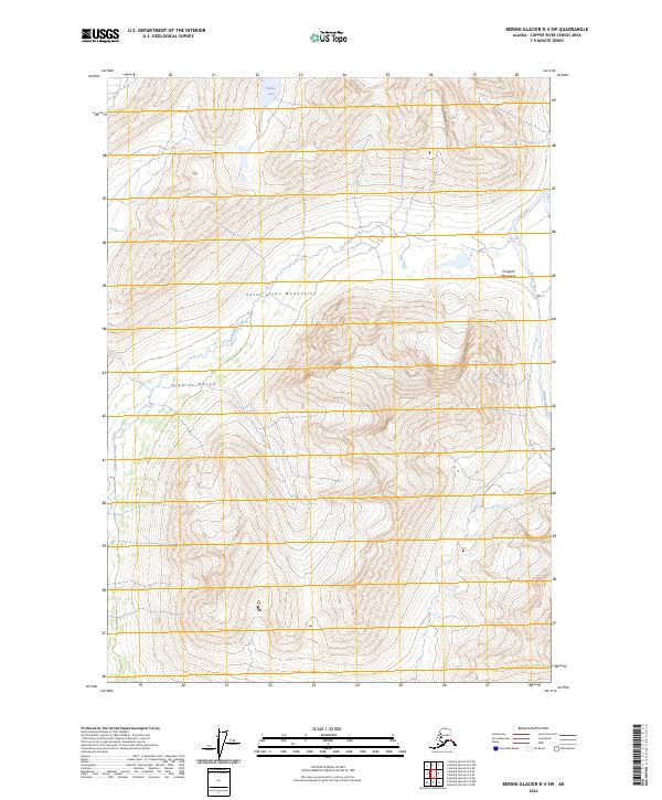
2024 Map of Bering Glacier D-4 SW
USGS Topo · Published 2024About this map
The Wrangell-St Elias Wilderness occupies the heart of this survey, marking a point where the massive Saint Elias Mountains converge with the Chugach Mountains. The landscape is defined by extreme elevation changes and ice-carved topography, including the sharp ridgeline of the Granite Range in the western reaches. This area is characterized by a high-alpine environment where glacial melt feeds a network of drainage systems. Martin Creek and Twelvemile Creek flow through deep valleys, while Slender Lake sits isolated in the northern portion of the quadrangle. Along the eastern edge, the Kiagna River cuts through the terrain, illustrating the powerful hydrological forces that continue to shape this portion of the Alaskan interior.
Find a feature on this map
14 named features on this map. Tap any name to fly to it.
Don’t see what you’re looking for? This feature index may not catch every label — zoom into the map to look around manually.
Map Details
Editions of this 2024 Bering Glacier D-4 SW Map
This is the sole edition of this map. No revisions or reprints were ever made.
Other maps of this area

1950 · Bering Glacier
USGS Topo · 1:250,000

1951 · Bering Glacier
USGS Topo · 1:250,000

1959 · Bering Glacier
USGS Topo · 1:250,000

1984 · Bering Glacier D-4
USGS Topo · 1:63,360

1984 · Bering Glacier D-5
USGS Topo · 1:63,360
1985 · Bering Glacier C-5
USGS Topo · 1:63,360
1985 · Bering Glacier C-4
USGS Topo · 1:63,360
2016 · Bering Glacier C-5 NE
USGS Topo · 1:25,000
2016 · Bering Glacier D-5 SE
USGS Topo · 1:25,000
2016 · Bering Glacier C-4 NE
USGS Topo · 1:25,000