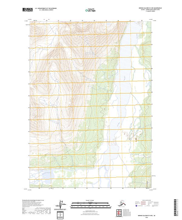
2024 Map of Bering Glacier D-5 NW
USGS Topo · Published 2024About this map
Wrangell-St. Elias Wilderness defines this remote glacial landscape, where massive ice fields and braided river systems dominate the terrain. The eastern portion of the sheet is shaped by the wide, shifting channels of the Tana River, which flows through a broad valley floor surrounded by dramatic elevation changes. To the southwest, the West Fork Tana River enters the frame, marking a significant hydrological junction in this protected interior. The Granite Range rises sharply in the southeast corner, providing a stark topographical contrast to the river plains. This survey represents the preservation of one of the most untouched regions in the Copper River Census Area, illustrating the complex drainage patterns and alpine geography characteristic of the Alaskan wilderness.
Find a feature on this map
8 named features on this map. Tap any name to fly to it.
Don’t see what you’re looking for? This feature index may not catch every label — zoom into the map to look around manually.
Map Details
Editions of this 2024 Bering Glacier D-5 NW Map
This is the sole edition of this map. No revisions or reprints were ever made.
Other maps of this area

1950 · Bering Glacier
USGS Topo · 1:250,000

1951 · McCarthy
USGS Topo · 1:250,000

1951 · Bering Glacier
USGS Topo · 1:250,000

1959 · McCarthy A-5
USGS Topo · 1:63,360

1959 · McCarthy A-6
USGS Topo · 1:63,360

1959 · Bering Glacier
USGS Topo · 1:250,000

1960 · McCarthy
USGS Topo · 1:250,000
1984 · Bering Glacier D-6
USGS Topo · 1:63,360

1984 · Bering Glacier D-5
USGS Topo · 1:63,360

1994 · McCarthy A-6
USGS Topo · 1:63,360