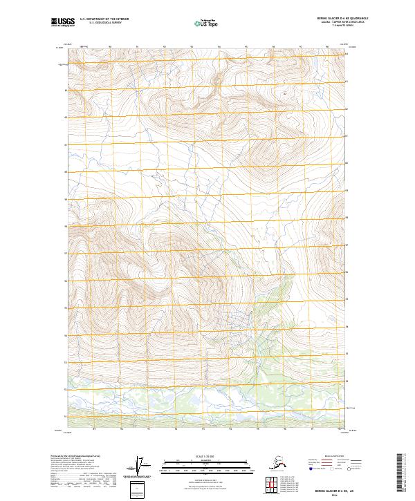
2024 Map of Bering Glacier D-6 NE
USGS Topo · Published 2024About this map
Wrangell-St. Elias Wilderness encompasses the majority of this Alaskan landscape, characterized by dramatic elevation changes and glaciated terrain within the Copper River Census Area. The southern portion of the quadrangle is defined by the braided drainage patterns of the West Fork Tana River, which flows through a broad valley floor amidst steep topographic contours. This 2024 survey captures the untouched character of the high wilderness, where the absence of roads and human structures highlights the region's preservation as a primitive natural environment. Researchers can observe the complex hydrography and glacial outwash plains that shape the basin, providing a detailed look at the modern state of this protected ecosystem.
Find a feature on this map
6 named features on this map. Tap any name to fly to it.
Don’t see what you’re looking for? This feature index may not catch every label — zoom into the map to look around manually.
Map Details
Editions of this 2024 Bering Glacier D-6 NE Map
This is the sole edition of this map. No revisions or reprints were ever made.
Other maps of this area

1950 · Bering Glacier
USGS Topo · 1:250,000

1951 · McCarthy
USGS Topo · 1:250,000

1951 · Bering Glacier
USGS Topo · 1:250,000

1959 · McCarthy A-5
USGS Topo · 1:63,360

1959 · McCarthy A-6
USGS Topo · 1:63,360

1959 · Bering Glacier
USGS Topo · 1:250,000

1960 · McCarthy
USGS Topo · 1:250,000
1984 · Bering Glacier D-6
USGS Topo · 1:63,360

1984 · Bering Glacier D-5
USGS Topo · 1:63,360

1994 · McCarthy A-6
USGS Topo · 1:63,360