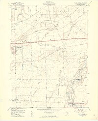
1959 Map of Berlin Heights
USGS Topo · Published 1960About this map
Berlin Heights stands as a central hub in this late-1950s landscape, where the agricultural traditions of northern Ohio meet the accelerating infrastructure of the post-war era. The Ohio Turnpike cuts a bold east-west path across the center of the sheet, providing a sharp contrast to the wandering courses of Old Woman Creek and Chappel Creek. This period captures a transition in transportation, as older rail corridors like the New York Central and Chicago St Louis Road still define the local geography alongside newer developments like Ortner Airport near the Vermilion River. Genealogists will find significant value in the numerous documented burial sites, including Riverside Cem and Poyers Cem, which serve as markers for the early families of Florence and Townsend townships. Small settlements like Ogontz and Ceylon appear as they did before further suburban expansion, anchored by local institutions such as the Townsend Sch.
Find a feature on this map
31 named features on this map. Tap any name to fly to it.
Don’t see what you’re looking for? This feature index may not catch every label — zoom into the map to look around manually.
Map Details
Editions of this 1959 Berlin Heights Map
2 editions found
Other maps of this area

1903 · Vermilion
USGS Topo · 1:62,500

1904 · Sandusky
USGS Topo · 1:62,500

1908 · New London
USGS Topo · 1:62,500

1915 · Norwalk
USGS Topo · 1:62,500

1944 · Norwalk
USGS Topo · 1:62,500

1956 · Toledo
USGS Topo · 1:250,000

1959 · Milan
USGS Topo · 1:24,000

1959 · Berlin Heights
USGS Topo · 1:24,000

1959 · Vermilion East
USGS Topo · 1:24,000

1959 · Vermilion West
USGS Topo · 1:24,000