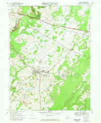
1967 Map of Berlin
USGS Topo · Published 1973About this map
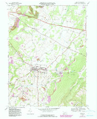
Berlin sits at the heart of this Somerset County landscape, serving as a hub for the surrounding Brothersvalley and Stonycreek townships. The local economy and infrastructure of the late 1960s are clearly defined by the heavy presence of extractive industries, with numerous Strip Mines and a Shaft located south of Macdonaldton. Transportation corridors dominate the north and south, from the Pennsylvania Toll Road Turnpike cutting across the top of the map to the Baltimore and Ohio railroad line passing through Niver Junction.
Find a feature on this map
49 named features on this map. Tap any name to fly to it.
Don’t see what you’re looking for? This feature index may not catch every label — zoom into the map to look around manually.
Map Details
Editions of this 1967 Berlin Map
5 editions found
Other maps of this area

1913 · Somerset
USGS Topo · 1:62,500

1914 · Windber
USGS Topo · 1:62,500

1915 · Somerset
USGS Topo · 1:62,500

1916 · Windber
USGS Topo · 1:62,500

1921 · Meyersdale
USGS Topo · 1:62,500

1923 · Berlin
USGS Topo · 1:48,000

1929 · Berlin
USGS Topo · 1:62,500

1939 · Meyersdale
USGS Topo · 1:62,500

1944 · Somerset
USGS Topo · 1:62,500

1944 · Windber
USGS Topo · 1:62,500
Featured Places
- Berlin, PA
- Somerset Township, PA
- Brotherton, Brothersvalley Township
- Macdonaldton, Brothersvalley Township
- Stonycreek Township, PA