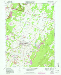
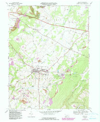
1967 Map of Berlin
USGS Topo · Published 1982About this map
Berlin sits at the heart of this Brothersvalley landscape, where the agricultural traditions of the Stonycreek Valley meet the industrial infrastructure of the late 1960s. The town's social fabric is anchored by the Berlin-Brothersvalley Joint Schs, the IOOF Cem, and the County Home for the Aged. To the north, the Pennsylvania Toll Road Turnpike cuts a modern path across the Glades, while the Baltimore and Ohio railroad serves the southern coal and freight interests.
Find a feature on this map
49 named features on this map. Tap any name to fly to it.
Don’t see what you’re looking for? This feature index may not catch every label — zoom into the map to look around manually.
Map Details
Editions of this 1967 Berlin Map
5 editions found
Other maps of this area

1913 · Somerset
USGS Topo · 1:62,500

1914 · Windber
USGS Topo · 1:62,500

1915 · Somerset
USGS Topo · 1:62,500

1916 · Windber
USGS Topo · 1:62,500

1921 · Meyersdale
USGS Topo · 1:62,500

1923 · Berlin
USGS Topo · 1:48,000

1929 · Berlin
USGS Topo · 1:62,500

1939 · Meyersdale
USGS Topo · 1:62,500

1944 · Somerset
USGS Topo · 1:62,500

1944 · Windber
USGS Topo · 1:62,500
Featured Places
- Berlin, PA
- Somerset Township, PA
- Brotherton, Brothersvalley Township
- Macdonaldton, Brothersvalley Township
- Stonycreek Township, PA