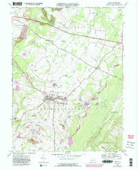
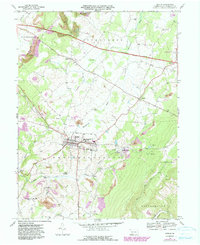
1967 Map of Berlin
USGS Topo · Published 1991About this map
Berlin serves as the focal point of this Somerset County landscape, situated at a vital convergence of local history and industry. The borough is anchored by institutions like the Berlin-Brothersvalley Joint Sch and the County Home for the Aged, while the IOOF Cem and several community churches underscore the area’s genealogical depth. This 1967 survey, with photorevised updates through the early 1980s, reveals a terrain defined by coal extraction and transit. Extensive Strip Mine operations and numerous smaller Mines dot the hillsides, particularly around Macdonaldton and Goodtown.
Find a feature on this map
52 named features on this map. Tap any name to fly to it.
Don’t see what you’re looking for? This feature index may not catch every label — zoom into the map to look around manually.
Map Details
Editions of this 1967 Berlin Map
5 editions found
Other maps of this area

1913 · Somerset
USGS Topo · 1:62,500

1914 · Windber
USGS Topo · 1:62,500

1915 · Somerset
USGS Topo · 1:62,500

1916 · Windber
USGS Topo · 1:62,500

1921 · Meyersdale
USGS Topo · 1:62,500

1923 · Berlin
USGS Topo · 1:48,000

1929 · Berlin
USGS Topo · 1:62,500

1939 · Meyersdale
USGS Topo · 1:62,500

1944 · Somerset
USGS Topo · 1:62,500

1944 · Windber
USGS Topo · 1:62,500
Featured Places
- Berlin, PA
- Somerset Township, PA
- Brotherton, Brothersvalley Township
- Macdonaldton, Brothersvalley Township
- Stonycreek Township, PA