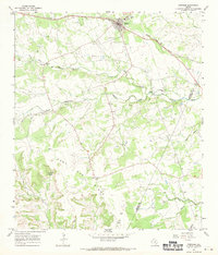
1967 Map of Bertram
USGS Topo · Published 1970About this map
Bertram serves as the primary hub on this Central Texas landscape, situated along the Southern Pacific railroad line. The settlement pattern in the late 1960s is defined by its proximity to the rail and the presence of numerous Gravel Pit operations that dot the northern terrain. South of the town, the land rises into the distinct elevation of Post Oak Ridge, where the terrain becomes more complex, marked by features such as Buzzard Roost and Flatrock Hollow.
Find a feature on this map
22 named features on this map. Tap any name to fly to it.
Don’t see what you’re looking for? This feature index may not catch every label — zoom into the map to look around manually.
Map Details
Editions of this 1967 Bertram Map
2 editions found
Other maps of this area

1887 · Burnet
USGS Topo · 1:125,000

1893 · Georgetown
USGS Topo · 1:125,000

1893 · Burnet
USGS Topo · 1:125,000

1903 · Burnet
USGS Topo · 1:125,000

1909 · Burnet
USGS Topo · 1:125,000

1932 · Bertram
USGS Topo · 1:62,500

1954 · Llano
USGS Topo · 1:250,000

1954 · Austin
USGS Topo · 1:250,000

1955 · Llano
USGS Topo · 1:250,000

1956 · Llano
USGS Topo · 1:250,000