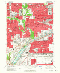
1963 Map of Berwyn
USGS Topo · Published 1965About this map
Industrial expansion and dense suburban growth converge along the Des Plaines River corridor in this mid-1960s study of western Cook County. The landscape is defined by its massive transportation and utility infrastructure, where the Chicago Sanitary and Ship Canal runs parallel to the Gulf Mobile and Ohio Railroad and the Illinois Central Railroad. Prominent institutions anchor the northern neighborhoods, including the sprawling VA Hospital at Hines and the Chicago Zoological Park in Riverside. Large-scale land use is further characterized by an extensive belt of cemeteries like Resurrection Cemetery and Forest Home Cemetery. The map captures the region's transition into a modern metropolitan hub, with the recently completed Eisenhower Expressway and Stevenson Expressway cutting through established townships such as Berwyn and Cicero.
Find a feature on this map
131 named features on this map. Tap any name to fly to it.
Don’t see what you’re looking for? This feature index may not catch every label — zoom into the map to look around manually.
Map Details
Editions of this 1963 Berwyn Map
3 editions found
Other maps of this area

1889 · Chicago
USGS Topo · 1:62,500

1890 · Des Plaines
USGS Topo · 1:62,500

1891 · Chicago
USGS Topo · 1:62,500

1891 · Riverside
USGS Topo · 1:62,500

1892 · Calumet
USGS Topo · 1:62,500

1893 · Calumet
USGS Topo · 1:62,500

1893 · Riverside
USGS Topo · 1:62,500

1894 · Des Plaines
USGS Topo · 1:62,500

1900 · Chicago
USGS Topo · 1:62,500

1900 · Des Plaines
USGS Topo · 1:62,500