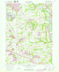
1958 Map of Bessemer
USGS Topo · Published 1979About this map
Mahoning River and Shenango River converge in this western Pennsylvania landscape, creating a hub of industrial and transit infrastructure. The area around New Castle and Mahoningtown shows a dense network of rail lines including the Baltimore and Ohio and Pittsburgh and Lake Erie railroads. This mid-century survey captures the region's heavy industry, from the sewage disposal plants and conveyors near Bessemer to the numerous strip mines that mark the southern terrain. Between these industrial centers lie established local landmarks like the Beech Woods Church and Jackson Knolls Gardens. The map also documents the Pennsylvania Toll Road Turnpike cutting through Little Beaver, illustrating the shift from river-and-rail dominance toward modern interstate travel in the post-war era.
Find a feature on this map
62 named features on this map. Tap any name to fly to it.
Don’t see what you’re looking for? This feature index may not catch every label — zoom into the map to look around manually.
Map Details
Editions of this 1958 Bessemer Map
4 editions found
Other maps of this area

1902 · New Castle
USGS Topo · 1:62,500

1904 · Newcastle
USGS Topo · 1:62,500

1905 · Neshannock
USGS Topo · 1:62,500

1906 · Youngstown
USGS Topo · 1:62,500

1907 · Neshannock
USGS Topo · 1:62,500

1907 · Columbiana
USGS Topo · 1:62,500

1908 · Youngstown
USGS Topo · 1:62,500

1909 · Columbiana
USGS Topo · 1:62,500

1950 · Cleveland
USGS Topo · 1:250,000

1951 · Canton
USGS Topo · 1:250,000