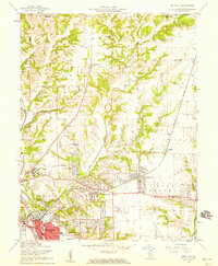
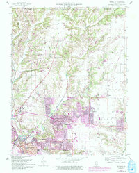
1954 Map of Bethalto
USGS Topo · Published 1959About this map
The industrialized landscape of East Alton and the growing residential corridors of Bethalto and Cottage Hills anchor this mid-1950s survey. The southern portion of the map is defined by the heavy infrastructure of the New York Central railroad and a significant industrial presence marked by Chemical Tanks and a Gas Tank near the Levee. The Alton State Hospital stands as a major landmark on the western edge, while the Civic Memorial Airport signals the era’s postwar aviation expansion.
Find a feature on this map
43 named features on this map. Tap any name to fly to it.
Don’t see what you’re looking for? This feature index may not catch every label — zoom into the map to look around manually.
Map Details
Editions of this 1954 Bethalto Map
5 editions found
Other maps of this area

1912 · Gillespie
USGS Topo · 1:62,500

1915 · Gillespie
USGS Topo · 1:62,500

1925 · Brighton
USGS Topo · 1:62,500

1927 · Alton
USGS Topo · 1:62,500

1927 · Edwardsville
USGS Topo · 1:62,500

1928 · Brighton
USGS Topo · 1:62,500

1932 · Edwardsville
USGS Topo · 1:62,500

1934 · Alton
USGS Topo · 1:62,500

1935 · Columbia Bottom
USGS Topo · 1:24,000

1948 · Quincy
USGS Topo · 1:250,000