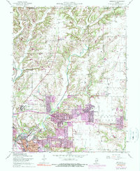
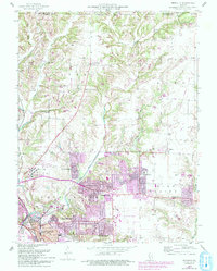
1954 Map of Bethalto
USGS Topo · Published 1990About this map
The East Fork Wood River and West Fork Wood River carve through the agricultural uplands of Madison County, framing a landscape in transition during the mid-20th century. While the northern reaches maintain a rural character around Fosterburg and Moro, the southern portion of the sheet reveals significant post-war development. The expanding residential footprints of Bethalto and Cottage Hills are clearly visible, supported by infrastructure like the Civic Memorial Airport and the sprawling grounds of the Alton State Hospital.
Find a feature on this map
42 named features on this map. Tap any name to fly to it.
Don’t see what you’re looking for? This feature index may not catch every label — zoom into the map to look around manually.
Map Details
Editions of this 1954 Bethalto Map
5 editions found
Other maps of this area

1912 · Gillespie
USGS Topo · 1:62,500

1915 · Gillespie
USGS Topo · 1:62,500

1925 · Brighton
USGS Topo · 1:62,500

1927 · Alton
USGS Topo · 1:62,500

1927 · Edwardsville
USGS Topo · 1:62,500

1928 · Brighton
USGS Topo · 1:62,500

1932 · Edwardsville
USGS Topo · 1:62,500

1934 · Alton
USGS Topo · 1:62,500

1935 · Columbia Bottom
USGS Topo · 1:24,000

1948 · Quincy
USGS Topo · 1:250,000