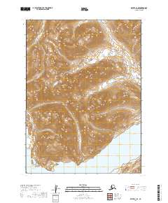
2019 Map of Bethel A-1 SE
USGS Topo · Published 2019About this map
Lake Chauekuktuli dominates the southeastern corner of this Alaskan interior landscape within the Dillingham Census Area. The terrain is characterized by dramatic elevation changes, with steep ridges rising from the shoreline toward high mountain peaks that define the western and northern portions of the quadrangle. In the southwest, the waters of Shadow Bay reach into the land, reflecting the complex aquatic network typical of this remote region. While largely devoid of named human settlements, the map is meticulously gridded for land management, showing the intersection of several townships including t1s r58w, t1s r57w, t2s r58w, and t2s r57w. This 2019 survey provides a precise look at the natural hydrography and topographical contours of the area before modern development, serving as a primary source for understanding the physical geography of this corner of Alaska.
Find a feature on this map
6 named features on this map. Tap any name to fly to it.
Don’t see what you’re looking for? This feature index may not catch every label — zoom into the map to look around manually.
Map Details
Editions of this 2019 Bethel A-1 SE Map
This is the sole edition of this map. No revisions or reprints were ever made.
Other maps of this area

1950 · Bethel
USGS Topo · 1:250,000

1950 · Taylor Mountains
USGS Topo · 1:250,000

1951 · Taylor Mountains
USGS Topo · 1:250,000

1951 · Dillingham
USGS Topo · 1:250,000

1951 · Goodnews
USGS Topo · 1:250,000

1954 · Taylor Mountains
USGS Topo · 1:250,000

1954 · Dillingham
USGS Topo · 1:250,000

1954 · Taylor Mountains A-8
USGS Topo · 1:63,360

1954 · Dillingham D-8
USGS Topo · 1:63,360

1979 · Bethel A-1
USGS Topo · 1:63,360