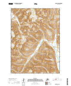
2019 Map of Bethel A-1 SW
USGS Topo · Published 2019About this map
Konarut Mtn dominates the southern reaches of this landscape, rising above a complex network of glacial ice and high-altitude lakes. The presence of Chikuminuk Glacier in the northern portion of the quadrangle illustrates the active cryosphere of the Dillingham Census Area, where ice movement continues to shape the underlying bedrock. Along the eastern edge, the waters of Lake Chauekuktuli mark the lower elevations of the terrain. The map depicts a wilderness largely defined by its natural topography rather than human infrastructure, showing the surveyor's focus on precise contouring and the relationship between permanent ice fields and local water bodies.
Find a feature on this map
7 named features on this map. Tap any name to fly to it.
Don’t see what you’re looking for? This feature index may not catch every label — zoom into the map to look around manually.
Map Details
Editions of this 2019 Bethel A-1 SW Map
This is the sole edition of this map. No revisions or reprints were ever made.
Other maps of this area

1950 · Bethel
USGS Topo · 1:250,000

1951 · Goodnews
USGS Topo · 1:250,000

1979 · Bethel A-1
USGS Topo · 1:63,360

1979 · Bethel A-2
USGS Topo · 1:63,360

1979 · Goodnews Bay D-1
USGS Topo · 1:63,360

1979 · Goodnews Bay
USGS Topo · 1:250,000

1979 · Goodnews Bay D-2
USGS Topo · 1:63,360

1980 · Bethel
USGS Topo · 1:250,000
2019 · Bethel A-1 NE
USGS Topo · 1:25,000
2019 · Bethel A-1 SE
USGS Topo · 1:25,000