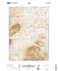
2017 Map of Bethel A-5 NE
USGS Topo · Published 2017About this map
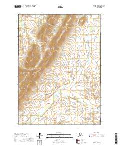
The Eek River carves a winding path through this corner of the Bethel Census Area, defining a landscape dominated by extensive wetlands and seasonal floodplains. This 2017 survey illustrates the complex hydrography of the Alaskan interior, where subtle elevation changes across T1n R65w and surrounding townships dictate the flow of water through an intricate network of unnamed ponds and marshes. The absence of roads or permanent settlements within these boundaries underscores the area's isolation and its reliance on the river as a primary natural corridor. Researchers can observe the interplay of township lines such as T2n R65w and T2n R66w against the irregular terrain, reflecting the systematic mapping of a region largely shaped by the forces of the Bering Sea lowlands.
Find a feature on this map
5 named features on this map. Tap any name to fly to it.
Don’t see what you’re looking for? This feature index may not catch every label — zoom into the map to look around manually.
Map Details
Editions of this 2017 Bethel A-5 NE Map
This is the sole edition of this map. No revisions or reprints were ever made.
Other maps of this area

1950 · Bethel
USGS Topo · 1:250,000

1954 · Bethel A-5
USGS Topo · 1:63,360

1954 · Bethel A-4
USGS Topo · 1:63,360

1954 · Bethel B-4
USGS Topo · 1:63,360

1954 · Bethel B-5
USGS Topo · 1:63,360

1980 · Bethel
USGS Topo · 1:250,000
2017 · Bethel A-5 SE
USGS Topo · 1:25,000
2017 · Bethel B-5 SE
USGS Topo · 1:25,000
2017 · Bethel B-4 SW
USGS Topo · 1:25,000
2017 · Bethel A-5 SW
USGS Topo · 1:25,000