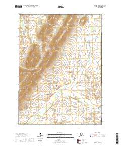
2017 Map of Bethel A-5 SW
USGS Topo · Published 2017About this map
Great Ridge rises as a prominent topographical spine within this portion of the Bethel Census Area, serving as the central drainage divide for the surrounding wilderness. The landscape is defined by the winding course of the Middle Fork Eek River, which meanders through the eastern and southern sections of the quadrangle. This 2017 survey details a remote interior region of Alaska characterized by complex wetland networks and high-elevation terrain, including the land divisions of t1s r67w, t1s r66w, t2s r67w, and t2s r66w. The intricate contour lines illustrate the stark elevation changes between the river valley floors and the peaks of the ridge, providing a clear view of the natural corridors used for navigation in this roadless expanse.
Find a feature on this map
6 named features on this map. Tap any name to fly to it.
Don’t see what you’re looking for? This feature index may not catch every label — zoom into the map to look around manually.
Map Details
Editions of this 2017 Bethel A-5 SW Map
This is the sole edition of this map. No revisions or reprints were ever made.
Other maps of this area

1950 · Bethel
USGS Topo · 1:250,000

1951 · Goodnews
USGS Topo · 1:250,000

1954 · Bethel A-5
USGS Topo · 1:63,360

1954 · Goodnews D-6
USGS Topo · 1:63,360

1954 · Goodnews D-5
USGS Topo · 1:63,360

1954 · Bethel A-6
USGS Topo · 1:63,360
1964 · Bethel A-6
USGS Topo · 1:63,360

1979 · Goodnews Bay
USGS Topo · 1:250,000

1980 · Bethel
USGS Topo · 1:250,000
2017 · Bethel A-5 SE
USGS Topo · 1:25,000