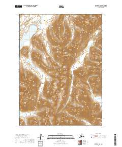
2019 Map of Bethel B-1 NE
USGS Topo · Published 2019About this map
Aniak Lake serves as a prominent landmark in this southwestern corner of Alaska, where the high-elevation terrain transitions between several major drainage systems. The northern reaches of the sheet are defined by the Aniak River, while the southern and eastern portions trace the headwaters of the Tikchik River. This 2019 survey documents a landscape defined entirely by its hydrography and elevation, devoid of modern roads or settlements. The topographic patterns show the complex relationship between these separate river systems as they emerge from the mountainous interior of the Dillingham Census Area.
Find a feature on this map
9 named features on this map. Tap any name to fly to it.
Don’t see what you’re looking for? This feature index may not catch every label — zoom into the map to look around manually.
Map Details
Editions of this 2019 Bethel B-1 NE Map
This is the sole edition of this map. No revisions or reprints were ever made.
Other maps of this area

1950 · Bethel
USGS Topo · 1:250,000

1950 · Taylor Mountains
USGS Topo · 1:250,000

1951 · Taylor Mountains
USGS Topo · 1:250,000

1954 · Taylor Mountains
USGS Topo · 1:250,000

1954 · Taylor Mountains B-8
USGS Topo · 1:63,360

1954 · Taylor Mountains C-8
USGS Topo · 1:63,360

1979 · Bethel B-1
USGS Topo · 1:63,360
1979 · Bethel C-1
USGS Topo · 1:63,360

1980 · Bethel
USGS Topo · 1:250,000
2019 · Bethel C-1 SE
USGS Topo · 1:25,000