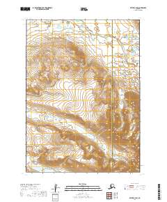
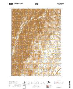
2019 Map of Bethel B-2 SW
USGS Topo · Published 2019About this map
Kisaralik River meanders through the northern reaches of this landscape, marking a significant drainage within the transition between the Bethel Census Area and the Dillingham Census Area. The terrain is defined by its complex hydrology, where Akaswift Creek and the various branches of Swift Cr carve through high-elevation contour lines that indicate substantial relief across the southwestern portion of the Bethel quadrangle. This 2019 survey captures the wilderness character of the region before any established road infrastructure, highlighting the natural watercourses that have historically dictated movement and subsistence in this part of Alaska. The boundary between the two census areas is a primary geographic feature, bisecting the eastern portion of the sheet and providing a reference point for local jurisdictional history and land management.
Find a feature on this map
8 named features on this map. Tap any name to fly to it.
Don’t see what you’re looking for? This feature index may not catch every label — zoom into the map to look around manually.
Map Details
Editions of this 2019 Bethel B-2 SW Map
This is the sole edition of this map. No revisions or reprints were ever made.
Other maps of this area

1950 · Bethel
USGS Topo · 1:250,000

1954 · Bethel B-3
USGS Topo · 1:63,360

1979 · Bethel A-3
USGS Topo · 1:63,360

1979 · Bethel A-2
USGS Topo · 1:63,360

1979 · Bethel B-2
USGS Topo · 1:63,360

1980 · Bethel
USGS Topo · 1:250,000
2019 · Bethel B-2 NE
USGS Topo · 1:25,000
2019 · Bethel A-3 NE
USGS Topo · 1:25,000
2019 · Bethel B-2 NW
USGS Topo · 1:25,000
2019 · Bethel B-3 NE
USGS Topo · 1:25,000