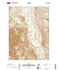
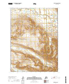
2019 Map of Bethel A-3 NE
USGS Topo · Published 2019About this map
Crooked Creek meanders through this interior Alaska landscape, defining a remote drainage system near the border of the Bethel and Dillingham Census Areas. This topographic study reveals a terrain of high ridges and narrow valleys where smaller tributaries like Mountain Creek and Sunset Creek carve through the high ground in Township 1 North, Range 61 West. The map captures the natural hydrological patterns of the region, including the headwaters of Windy Creek and Little Swift Creek. Without any marked roads or permanent settlements, the landscape represents an untouched segment of the Alaskan wilderness, where elevation contours and watercourses are the primary navigational landmarks for those traversing the census area boundaries.
Find a feature on this map
13 named features on this map. Tap any name to fly to it.
Don’t see what you’re looking for? This feature index may not catch every label — zoom into the map to look around manually.
Map Details
Editions of this 2019 Bethel A-3 NE Map
This is the sole edition of this map. No revisions or reprints were ever made.
Other maps of this area

1950 · Bethel
USGS Topo · 1:250,000

1954 · Bethel B-3
USGS Topo · 1:63,360

1979 · Bethel A-3
USGS Topo · 1:63,360

1979 · Bethel A-2
USGS Topo · 1:63,360

1979 · Bethel B-2
USGS Topo · 1:63,360

1980 · Bethel
USGS Topo · 1:250,000
2019 · Bethel A-3 SE
USGS Topo · 1:25,000
2019 · Bethel B-3 SE
USGS Topo · 1:25,000
2019 · Bethel B-3 SW
USGS Topo · 1:25,000
2019 · Bethel B-2 SW
USGS Topo · 1:25,000