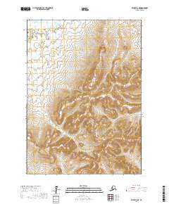
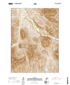
2017 Map of Bethel B-6 NE
USGS Topo · Published 2017About this map
Coral Creek flows through the southeastern portion of this terrain in the t4n r67w and t3n r67w townships. The landscape is defined by its dramatic elevation changes, with the t4n r67w township containing significant upland features that descend into the low-lying wetland drainage systems characteristic of the Bethel Census Area. The lack of named settlements or roads underscores the wilderness nature of this region during this period, leaving the natural topography and the watercourse of Coral Creek as the primary landmarks for navigation and land management. The grid layout provided by the t5n r67w, t5n r66w, and t4n r68w township boundaries offers a technical framework for understanding the land divisions in this remote part of Alaska.
Find a feature on this map
7 named features on this map. Tap any name to fly to it.
Don’t see what you’re looking for? This feature index may not catch every label — zoom into the map to look around manually.
Map Details
Editions of this 2017 Bethel B-6 NE Map
This is the sole edition of this map. No revisions or reprints were ever made.
Other maps of this area

1950 · Bethel
USGS Topo · 1:250,000

1954 · Bethel B-6
USGS Topo · 1:63,360

1954 · Bethel C-6
USGS Topo · 1:63,360

1954 · Bethel C-5
USGS Topo · 1:63,360

1954 · Bethel B-5
USGS Topo · 1:63,360

1980 · Bethel
USGS Topo · 1:250,000
2017 · Bethel B-6 SW
USGS Topo · 1:25,000
2017 · Bethel C-6 SW
USGS Topo · 1:25,000
2017 · Bethel B-6 NW
USGS Topo · 1:25,000
2017 · Bethel B-5 NW
USGS Topo · 1:25,000