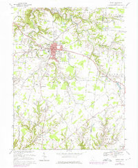
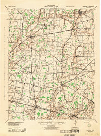
1968 Map of Bethel
USGS Topo · Published 1976About this map
Bethel serves as the primary hub of this landscape, situated at a junction of regional roads that connect the surrounding farmsteads and creek valleys. The village is well-established with civic structures including an Auditorium, the Bethel-Tate High Sch, and several local congregations such as North Side Ch and St Marys Ch. To the north, the Bethel Reservoir and its associated Filtration Plant indicate the infrastructure supporting the growing community during the mid-20th century.
Find a feature on this map
52 named features on this map. Tap any name to fly to it.
Don’t see what you’re looking for? This feature index may not catch every label — zoom into the map to look around manually.
Map Details
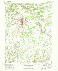
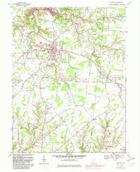
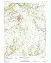
Editions of this 1968 Bethel Map
4 editions found
Other maps of this area

1914 · Batavia
USGS Topo · 1:48,000

1916 · Batavia
USGS Topo · 1:62,500

1917 · Sardinia
USGS Topo · 1:62,500

1928 · Higginsport
USGS Topo · 1:48,000

1931 · Felicity
USGS Topo · 1:62,500

1931 · Higginsport
USGS Topo · 1:62,500
1944 · Sardinia
USGS Topo · 1:62,500

1947 · Columbus
USGS Topo · 1:250,000
1952 · Higginsport
USGS Topo · 1:24,000
1953 · Laurel
USGS Topo · 1:24,000
Featured Places
- Bethel, Tate Township
- Mount Olive, Franklin Township
- Washington Township, OH
- Franklin Township, OH
- Tate Township, OH