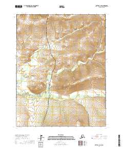
2017 Map of Bettles C-2 NE
USGS Topo · Published 2017About this map
The Alaska Pipeline and the Dalton Highway run parallel through this remote Arctic landscape, following a north-south corridor that serves as the primary artery for energy transport and supplies in the Yukon-Koyukuk region. This 2017 survey shows the intersection of modern industrial infrastructure with a complex network of waterways, including Bonanza Cr and its tributaries, the N Fork Bonanza Cr and S Fork Bonanza Cr. The map details the drainage patterns and significant elevation changes across townships such as T22n R15w and T21n R14w. The arrangement of the highway and pipeline against the winding river forks illustrates the engineering challenges inherent in traversing this northern wilderness while maintaining critical logistics and resource routes.
Find a feature on this map
9 named features on this map. Tap any name to fly to it.
Don’t see what you’re looking for? This feature index may not catch every label — zoom into the map to look around manually.
Map Details
Editions of this 2017 Bettles C-2 NE Map
This is the sole edition of this map. No revisions or reprints were ever made.
Other maps of this area

1951 · Bettles
USGS Topo · 1:250,000

1956 · Bettles
USGS Topo · 1:250,000
1970 · Bettles D-1
USGS Topo · 1:63,360
1970 · Bettles C-1
USGS Topo · 1:63,360

1970 · Bettles C-2
USGS Topo · 1:63,360

1970 · Bettles D-2
USGS Topo · 1:63,360
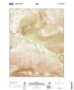
2017 · Bettles C-2 SW
USGS Topo · 1:25,000
2017 · Bettles C-1 SW
USGS Topo · 1:25,000
2017 · Bettles D-1 SW
USGS Topo · 1:25,000
2017 · Bettles C-2 SE
USGS Topo · 1:25,000