
1970 Map of Bettles D-4
USGS Topo · Published 1973About this map
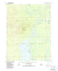
The Koyukuk River and John River converge in this subarctic wilderness, creating a complex network of wetlands and sloughs such as Goose Slough and Horseshoe Lake. In the early 1970s, the settlement of Evansville served as a vital transportation node, featuring a Boat and Seaplane Landing Area and Bettles Field for interior access. The landscape is defined by the Alatna Hills to the west and Lookout Mountain, with a Winter Trail providing the only overland connection through the marshy lowlands of Fickett Creek and Jane Creek. Local history is anchored at the Bettles Cem, while technical infrastructure is represented by several Radio Towers and the Bettles S Base survey marker.
Find a feature on this map
20 named features on this map. Tap any name to fly to it.
Don’t see what you’re looking for? This feature index may not catch every label — zoom into the map to look around manually.
Map Details
Editions of this 1970 Bettles D-4 Map
2 editions found
Other maps of this area

1951 · Bettles
USGS Topo · 1:250,000

1951 · Wiseman
USGS Topo · 1:250,000

1956 · Bettles
USGS Topo · 1:250,000

1956 · Wiseman
USGS Topo · 1:250,000

1964 · Wiseman
USGS Topo · 1:250,000

1970 · Wiseman A-4
USGS Topo · 1:63,360

1970 · Bettles C-4
USGS Topo · 1:63,360

1970 · Wiseman A-3
USGS Topo · 1:63,360
1970 · Bettles C-5
USGS Topo · 1:63,360

1970 · Bettles D-3
USGS Topo · 1:63,360