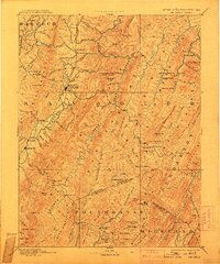
1892 Map of Beverly
USGS Topo · Published 1907About this map
The Tygart River valley and the high ridges of the Alleghenies define this 1892 survey of central West Virginia. Beverly serves as a primary settlement along the river, flanked by smaller communities like Valley Bend and Huttonsville. The topography is dominated by parallel mountain ranges, including Rich Mountain and Laurel Hill, which funnel the drainage of the Cheat River and its various forks.
Find a feature on this map
134 named features on this map. Tap any name to fly to it.
Don’t see what you’re looking for? This feature index may not catch every label — zoom into the map to look around manually.
Map Details
Editions of this 1892 Beverly Map
5 editions found
Other maps of this area

1886 · St. George
USGS Topo · 1:125,000

1889 · Beverly
USGS Topo · 1:125,000

1891 · Huntersville
USGS Topo · 1:125,000

1891 · St. George
USGS Topo · 1:125,000

1892 · Beverly
USGS Topo · 1:125,000

1892 · Franklin
USGS Topo · 1:125,000

1893 · Buckhannon
USGS Topo · 1:125,000

1894 · Huntersville
USGS Topo · 1:125,000

1894 · Staunton
USGS Topo · 1:125,000

1895 · Piedmont
USGS Topo · 1:125,000