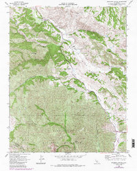
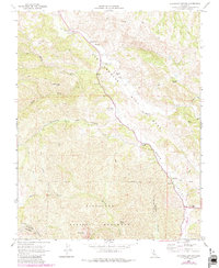
1968 Map of Bickmore Canyon
USGS Topo · Published 1984About this map
Pinnacles National Monument dominates the southern landscape of this Central Coast survey, where the Gabilan Range meets the unmistakable path of the San Andreas Rift Zone. The geography is defined by sharp elevation shifts between the volcanic spires of the Balconies and the broad alluvial floor of Bear Valley. Along the San Benito River, the map documents a series of established holdings including Melendy Ranch and Bear Valley Ranch, reflecting the region's enduring ranching economy.
Find a feature on this map
30 named features on this map. Tap any name to fly to it.
Don’t see what you’re looking for? This feature index may not catch every label — zoom into the map to look around manually.
Map Details
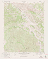
Editions of this 1968 Bickmore Canyon Map
6 editions found
Other maps of this area

1915 · Soledad
USGS Topo · 1:62,500

1919 · San Benito
USGS Topo · 1:62,500

1921 · Gonzales
USGS Topo · 1:62,500

1921 · Metz
USGS Topo · 1:62,500

1931 · San Benito
USGS Topo · 1:62,500

1940 · Metz
USGS Topo · 1:62,500

1940 · Soledad
USGS Topo · 1:62,500

1940 · San Benito
USGS Topo · 1:62,500
1940 · Gonzales
USGS Topo · 1:62,500
1941 · Gonzales
USGS Topo · 1:62,500