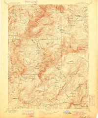
1897 Map of Bidwell Bar
USGS Topo · Published 1901About this map
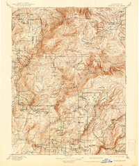
Gold-rush era infrastructure defines the landscape across the Sierra Nevada foothills on this late nineteenth-century survey. The terrain is deeply carved by the West Branch Feather River and its various forks, where early industry is evidenced by sites like Old Defiance Mill, Hutchins Mill, and Snows Mine. While larger settlements like Forbestown and Merrimac serve as regional hubs, the map reveals a denser network of waypoints and mountain houses essential to the travel of the period, including Bucks Ranch, American House, and North Star House.
Find a feature on this map
169 named features on this map. Tap any name to fly to it.
Don’t see what you’re looking for? This feature index may not catch every label — zoom into the map to look around manually.
Map Details
Editions of this 1897 Bidwell Bar Map
7 editions found

Other maps of this area

1886 · Honey Lake
USGS Topo · 1:250,000

1886 · Lassen Peak
USGS Topo · 1:250,000

1888 · Marysville
USGS Topo · 1:125,000

1888 · Smartsville
USGS Topo · 1:125,000

1888 · Bidwell Bar
USGS Topo · 1:125,000

1891 · Bidwell Bar
USGS Topo · 1:125,000

1891 · Chico
USGS Topo · 1:125,000

1891 · Downieville
USGS Topo · 1:125,000

1891 · Honey Lake
USGS Topo · 1:250,000

1891 · Colfax
USGS Topo · 1:125,000