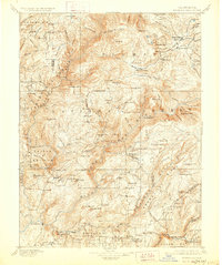
1897 Map of Bidwell Bar
USGS Topo · Published 1928About this map
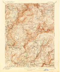
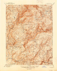
Bidwell Bar and the surrounding gold-country landscape are preserved here based on late-nineteenth-century surveys by Henry Gannett and A.H. Thompson. The map reveals a transition from active resource extraction to forest management within the Lassen N. F. and Plumas National Forest. Early industrial sites such as Snows Mine, Harts Mill, and the Old Defiance Mill dot the drainages of the Middle and South Forks of the Feather River. Numerous stopping points and social hubs are recorded, including Junction House, Mt. Hope House, and American House, reflecting a time when travel through the Sierra Nevada relied on these established waystations. The detailed topography highlights the significant elevations of Spanish Peak and Bucks Mt., while also documenting the early footprint of settlements like Forbestown and Mooretown before subsequent development and environmental changes altered the region's river valleys.
Find a feature on this map
138 named features on this map. Tap any name to fly to it.
Don’t see what you’re looking for? This feature index may not catch every label — zoom into the map to look around manually.
Map Details
Editions of this 1897 Bidwell Bar Map
7 editions found

Other maps of this area

1886 · Honey Lake
USGS Topo · 1:250,000

1886 · Lassen Peak
USGS Topo · 1:250,000

1888 · Marysville
USGS Topo · 1:125,000

1888 · Smartsville
USGS Topo · 1:125,000

1888 · Bidwell Bar
USGS Topo · 1:125,000

1891 · Bidwell Bar
USGS Topo · 1:125,000

1891 · Chico
USGS Topo · 1:125,000

1891 · Downieville
USGS Topo · 1:125,000

1891 · Honey Lake
USGS Topo · 1:250,000

1891 · Colfax
USGS Topo · 1:125,000